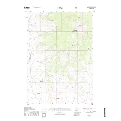
2020 Map of Polaris
USGS Topo · Published 2020About this map
Polaris stands at the northern edge of the Grasshopper Valley, where the open rangeland meets the high elevations of the Pioneer Mountains. This landscape is defined by its water sources and timber, with much of the eastern and northern portions of the quadrangle protected within the Beaverhead National Forest. Significant peaks such as Baldy Mtn and Black Mtn tower over a network of seasonal and perennial streams including Billings Cr, Scudder Cr, and Grasshopper Creek. Notable landmarks for local history include Old Faithful Spring and Lockridge Spring, which likely served as vital stopovers in this arid terrain. The map details the transition from valley bottom to high alpine basins like the one containing Scott Lake, providing a clear view of the ranching and forest-service roads that lace through Sheep Canyon and across Garrett Hill.
Find a feature on this map
42 named features on this map. Tap any name to fly to it.
Don’t see what you’re looking for? This feature index may not catch every label — zoom into the map to look around manually.
Map Details
Editions of this 2020 Polaris Map
This is the sole edition of this map. No revisions or reprints were ever made.
Other maps of this area

1893 · Dillon
USGS Topo · 1:250,000

1952 · Bannack
USGS Topo · 1:24,000

1952 · Torrey Mountain
USGS Topo · 1:24,000

1952 · Ermont
USGS Topo · 1:24,000

1955 · Dillon
USGS Topo · 1:250,000

1957 · Dillon
USGS Topo · 1:250,000

1958 · Dillon
USGS Topo · 1:250,000

1959 · Polaris
USGS Topo · 1:62,500

1959 · Grant
USGS Topo · 1:62,500

1962 · Dillon
USGS Topo · 1:250,000