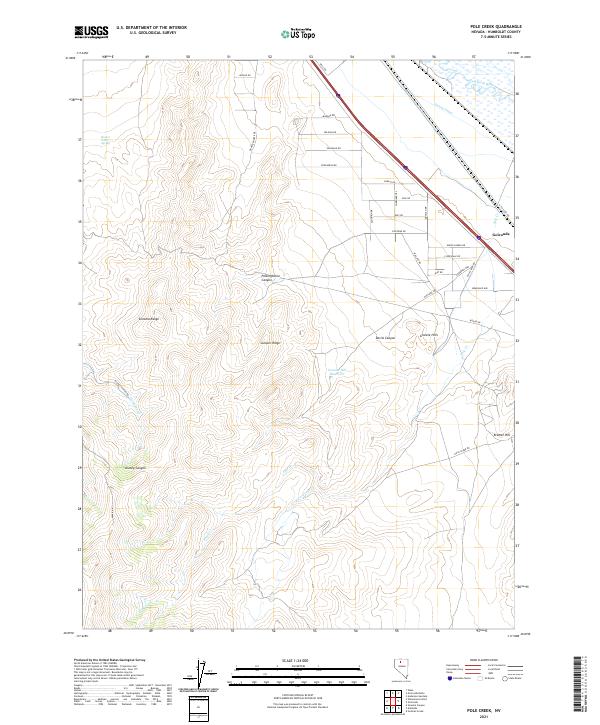
2021 Map of Pole Creek
USGS Topo · Published 2021About this map
The settlement of Golconda sits at the edge of the Humboldt River corridor, where the valley floor meets the high desert slopes of the Sonoma Range. This region is defined by the intersection of vital water infrastructure and steep topography, featuring the French Canal and the Granite Hill Reservoir. The landscape is marked by numerous drainage systems and landforms including Polkinghorne Canyon, Kluncy Canyon, and Juniper Ridge, illustrating the complex watershed of Pole Cr and its E Fork Pole Cr.
Find a feature on this map
45 named features on this map. Tap any name to fly to it.
Don’t see what you’re looking for? This feature index may not catch every label — zoom into the map to look around manually.
Map Details
Editions of this 2021 Pole Creek Map
This is the sole edition of this map. No revisions or reprints were ever made.
Other maps of this area

1882 · Paradise
USGS Topo · 1:250,000

1893 · Paradise
USGS Topo · 1:250,000

1932 · Sonoma Range
USGS Topo · 1:250,000

1939 · Sonoma Range
USGS Topo · 1:250,000

1945 · Osgood Mountains
USGS Topo · 1:62,500

1947 · Osgood Mountains
USGS Topo · 1:62,500

1955 · McDermitt
USGS Topo · 1:250,000

1955 · Winnemucca
USGS Topo · 1:250,000

1958 · Winnemucca
USGS Topo · 1:250,000

1958 · Winnemucca
USGS Topo · 1:62,500