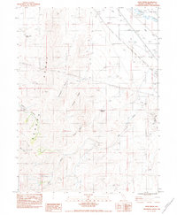
1983 Map of Pole Creek
USGS Topo · Published 1983About this map
The Humboldt River winds through the northeast corner of this arid landscape, accompanied by the engineered path of the French Canal. This 1983 provisional map documents the drainage patterns of the Sonoma Range, where numerous canyons such as Polkinghorne Canyon and Devils Canyon cut through the high ground of Juniper Ridge. These seasonal waterways converge toward the valley floor, supporting isolated water sources like Button Point Spring and the Granite Hill Reservoir.
Find a feature on this map
19 named features on this map. Tap any name to fly to it.
Don’t see what you’re looking for? This feature index may not catch every label — zoom into the map to look around manually.
Map Details
Editions of this 1983 Pole Creek Map
This is the sole edition of this map. No revisions or reprints were ever made.
Other maps of this area

1882 · Paradise
USGS Topo · 1:250,000

1893 · Paradise
USGS Topo · 1:250,000

1932 · Sonoma Range
USGS Topo · 1:250,000

1939 · Sonoma Range
USGS Topo · 1:250,000

1945 · Osgood Mountains
USGS Topo · 1:62,500

1947 · Osgood Mountains
USGS Topo · 1:62,500

1955 · McDermitt
USGS Topo · 1:250,000

1955 · Winnemucca
USGS Topo · 1:250,000

1958 · Winnemucca
USGS Topo · 1:250,000

1958 · Winnemucca
USGS Topo · 1:62,500