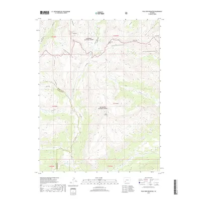
2019 Map of Pole Creek Mountain
USGS Topo · Published 2019About this map
Pole Creek Mtn and the surrounding high-altitude drainage systems of the San Juan and Hinsdale county line are meticulously detailed in this modern survey. The Continental Divide serves as a primary geographic spine, separating the headwaters of the Rio Grande to the south from the northern-flowing waters of Cataract Gulch and Cuba Gulch. High-elevation water bodies like Cataract Lake are caught in the steep terrain between peaks such as Half Peak and Carson Peak. The map illustrates a complex network of glacial valleys and mountain trails, including a significant stretch of the Continental Divide National Scenic Trail and the W Pole Trail. These routes follow the natural corridors formed by Pole Cr and its various forks, providing a clear record of the access points into the Gunnison National Forest and Rio Grande National Forest high country.
Find a feature on this map
30 named features on this map. Tap any name to fly to it.
Don’t see what you’re looking for? This feature index may not catch every label — zoom into the map to look around manually.
Map Details
Editions of this 2019 Pole Creek Mountain Map
This is the sole edition of this map. No revisions or reprints were ever made.
Other maps of this area

1897 · Silverton
USGS Topo · 1:62,500

1900 · Needle Mountains
USGS Topo · 1:62,500

1901 · Silverton
USGS Topo · 1:62,500

1902 · Needle Mountains
USGS Topo · 1:62,500

1902 · Silverton
USGS Topo · 1:62,500

1905 · San Cristobal
USGS Topo · 1:125,000

1907 · San Cristobal
USGS Topo · 1:125,000

1945 · Durango
USGS Topo · 1:250,000

1953 · Durango
USGS Topo · 1:250,000

1954 · Durango
USGS Topo · 1:250,000