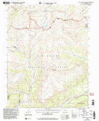
2001 Map of Pole Creek Mountain
USGS Topo · Published 2005About this map
Continental Divide serpentines across this high-altitude landscape, marking the hydrological crest between the Gunnison National Forest to the north and Rio Grande National Forest to the south. The terrain is defined by dramatic peaks such as Carson Peak and Bent Peak, which overlook the headwaters of the Rio Grande and its complex network of tributaries including Lost Trail Creek and the various forks of Pole Creek. Historic mining activity is indicated by several prospects located near the divide, suggesting the area's legacy of mineral exploration.
Find a feature on this map
29 named features on this map. Tap any name to fly to it.
Don’t see what you’re looking for? This feature index may not catch every label — zoom into the map to look around manually.
Map Details
Editions of this 2001 Pole Creek Mountain Map
This is the sole edition of this map. No revisions or reprints were ever made.
Other maps of this area

1897 · Silverton
USGS Topo · 1:62,500

1900 · Needle Mountains
USGS Topo · 1:62,500

1901 · Silverton
USGS Topo · 1:62,500

1902 · Needle Mountains
USGS Topo · 1:62,500

1902 · Silverton
USGS Topo · 1:62,500

1905 · San Cristobal
USGS Topo · 1:125,000

1907 · San Cristobal
USGS Topo · 1:125,000

1945 · Durango
USGS Topo · 1:250,000

1953 · Durango
USGS Topo · 1:250,000

1954 · Durango
USGS Topo · 1:250,000