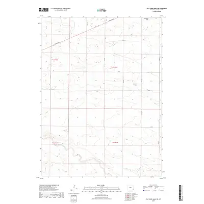
2017 Map of Pole Creek Ranch SE
USGS Topo · Published 2017About this map
Lodgepole Creek meanders across the southern landscape of this Laramie County region, carving a low-lying valley through the high plains of southeastern Wyoming. This 2017 survey reflects the enduring cattle-ranching and agricultural heritage of the area, where the terrain is defined by dry drainage features like Antelope Draw and Chivington Draw. The map documents a sparse but essential network of rural roads that support local land management and transportation, including the diagonal path of Torrington Rd and the straight-line reliability of Divide Rd. These routes connect isolated sections within townships like t16n r65w and t16n r64w, illustrating how the Public Land Survey System continues to dictate the spatial organization of this open country.
Find a feature on this map
20 named features on this map. Tap any name to fly to it.
Don’t see what you’re looking for? This feature index may not catch every label — zoom into the map to look around manually.
Map Details
Editions of this 2017 Pole Creek Ranch SE Map
This is the sole edition of this map. No revisions or reprints were ever made.
Other maps of this area

1911 · Cheyenne
USGS Topo · 1:125,000

1914 · Cheyenne
USGS Topo · 1:125,000

1954 · Cheyenne
USGS Topo · 1:250,000

1958 · Cheyenne
USGS Topo · 1:250,000

1963 · Little Indian Draw
USGS Topo · 1:24,000

1963 · Pole Creek Ranch SE
USGS Topo · 1:24,000

1963 · Midway
USGS Topo · 1:24,000

1963 · Durham
USGS Topo · 1:24,000

1963 · Midway SW
USGS Topo · 1:24,000
1963 · Pole Creek Ranch
USGS Topo · 1:24,000