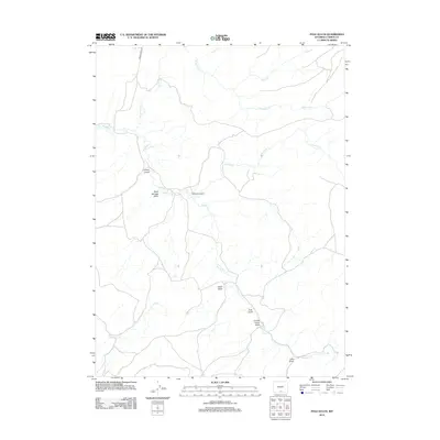
2012 Map of Pole Gulch
USGS Topo · Published 2012About this map
McKeil Homestead serves as a lone human landmark in this high-desert drainage system of Carbon County, where a network of ephemeral creeks and draws defines the landscape. The geography is dominated by the winding course of Muddy Cr, which is fed by numerous tributaries including McKinney Cr, Littlefield Cr, and Cow Cr. These waterways have carved a series of named depressions across the terrain, such as Horse Gulch and Buck Springs Draw in the northwest, and Pole Gulch to the southeast. Access to this remote region is facilitated by the historic corridor of Bridger Pass Rd, which cuts through the northern sections of the quadrangle. Other notable topographical features include Cabin Draw, Canary Grove Draw, and Lake Draw, illustrating a complex watershed that has long influenced land use and ranching in this part of Wyoming.
Find a feature on this map
14 named features on this map. Tap any name to fly to it.
Don’t see what you’re looking for? This feature index may not catch every label — zoom into the map to look around manually.
Map Details
Editions of this 2012 Pole Gulch Map
This is the sole edition of this map. No revisions or reprints were ever made.
Other maps of this area

1932 · Savery
USGS Topo · 1:96,000

1940 · Savery
USGS Topo · 1:125,000

1954 · Rawlins
USGS Topo · 1:250,000

1956 · Bridger Pass
USGS Topo · 1:62,500

1957 · Doty Mountain
USGS Topo · 1:62,500

1958 · Rawlins
USGS Topo · 1:250,000

1961 · Pine Grove Ranch
USGS Topo · 1:24,000

1961 · Ketchum Buttes
USGS Topo · 1:24,000

1961 · Pole Gulch
USGS Topo · 1:24,000
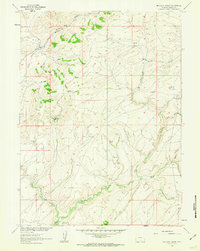
1961 · Mc Carty Ranch
USGS Topo · 1:24,000