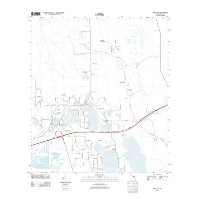
2012 Map of Polk City
USGS Topo · Published 2012About this map
Lake-strewn terrain and private aviation facilities define this portion of Polk County during the early 21st century. The landscape is dominated by a chain of water bodies, including Lake Agnes, Lake Juliana, and Lake Mattie, which shaped the local road network and residential development patterns. Unlike many more urbanized Florida quadrangles, this area maintains a significant number of small-scale airfields such as Cherokee Ranch Airport, Flanders Field Airport, and the Orlampa Inc Airport, suggesting a legacy of private flight and recreational land use.
Find a feature on this map
103 named features on this map. Tap any name to fly to it.
Don’t see what you’re looking for? This feature index may not catch every label — zoom into the map to look around manually.
Map Details
Editions of this 2012 Polk City Map
This is the sole edition of this map. No revisions or reprints were ever made.
Other maps of this area

1944 · Providence
USGS Topo · 1:31,680

1944 · Polk City
USGS Topo · 1:31,680

1944 · Lakeland
USGS Topo · 1:31,680

1944 · Auburndale
USGS Topo · 1:31,680

1955 · Orlando
USGS Topo · 1:250,000

1957 · Orlando
USGS Topo · 1:250,000

1958 · Orlando
USGS Topo · 1:250,000

1959 · Gum Lake
USGS Topo · 1:24,000

1959 · Lake Louisa SW
USGS Topo · 1:24,000

1959 · Poyner
USGS Topo · 1:24,000