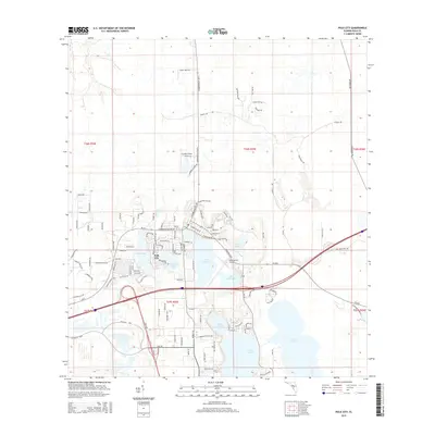
2015 Map of Polk City
USGS Topo · Published 2015About this map
Polk City serves as the central hub of this Florida landscape, situated within a dense network of freshwater lakes. The town sits at the intersection of several local routes, surrounded by water bodies including Mud Lake, Clearwater Lake, and the larger Lake Agnes. To the north, the settlement of Flanders Field is reached via Commonwealth Ave N, while the eastern portion of the map transitions into a more rural grid characterized by long stretches like Old Grade Rd and Fussell Rd.
Find a feature on this map
116 named features on this map. Tap any name to fly to it.
Don’t see what you’re looking for? This feature index may not catch every label — zoom into the map to look around manually.
Map Details
Editions of this 2015 Polk City Map
This is the sole edition of this map. No revisions or reprints were ever made.
Other maps of this area

1944 · Providence
USGS Topo · 1:31,680

1944 · Polk City
USGS Topo · 1:31,680

1944 · Lakeland
USGS Topo · 1:31,680

1944 · Auburndale
USGS Topo · 1:31,680

1955 · Orlando
USGS Topo · 1:250,000

1957 · Orlando
USGS Topo · 1:250,000

1958 · Orlando
USGS Topo · 1:250,000

1959 · Gum Lake
USGS Topo · 1:24,000

1959 · Lake Louisa SW
USGS Topo · 1:24,000

1959 · Poyner
USGS Topo · 1:24,000