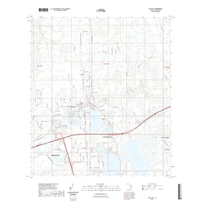
2021 Map of Polk City
USGS Topo · Published 2021About this map
Polk City sits at the heart of this Central Florida landscape, positioned between the conservation lands of the Green Swamp to the north and the increasingly developed corridor of Auburndale and Lakeland to the south. The map documents a region defined by its numerous water bodies, ranging from the expansive Lake Juliana and Lake Mattie to the clusters of smaller basins like Lake Tennessee and Lake Agnes. Transport and recreation infrastructure are prominently featured, including the General James A Van Fleet State Trail, which cuts a straight path north from Polk City. Local aviation history is represented by the Orlampa Inc Airport, while family and place-named roads like Fussell Rd and Hagan Rd provide clues for local history researchers tracing the area's transition from rural citrus and swamp land to a modern residential and transportation hub.
Find a feature on this map
127 named features on this map. Tap any name to fly to it.
Don’t see what you’re looking for? This feature index may not catch every label — zoom into the map to look around manually.
Map Details
Editions of this 2021 Polk City Map
This is the sole edition of this map. No revisions or reprints were ever made.
Other maps of this area

1944 · Providence
USGS Topo · 1:31,680

1944 · Polk City
USGS Topo · 1:31,680

1944 · Lakeland
USGS Topo · 1:31,680

1944 · Auburndale
USGS Topo · 1:31,680

1955 · Orlando
USGS Topo · 1:250,000

1957 · Orlando
USGS Topo · 1:250,000

1958 · Orlando
USGS Topo · 1:250,000

1959 · Gum Lake
USGS Topo · 1:24,000

1959 · Lake Louisa SW
USGS Topo · 1:24,000

1959 · Poyner
USGS Topo · 1:24,000