
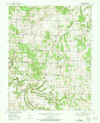
1950 Map of Polk
USGS Topo · Published 1966About this map
Polk and the surrounding rural communities of Huron, Goodson, and Violet characterize this mid-century landscape in Polk County. The terrain is defined by the winding course of the Pomme de Terre River and its numerous tributaries, including Lindley Creek and Hominy Creek. The map reveals a high density of rural schoolhouses and churches, such as Green Leaf Sch, Eidson Sch, and Spring Valley Ch, which served as the primary social anchors for the scattered farmsteads of the era. The presence of Jefferson Bridge provides a specific crossing point over the river, while several family-named burial grounds like Payne Cem and Goff Cem offer vital clues for genealogical research. The mapping, based on 1938 aerial photography and 1949-1950 field surveys, captures the region's agricultural layout before significant late-20th-century modernization.
Find a feature on this map
33 named features on this map. Tap any name to fly to it.
Don’t see what you’re looking for? This feature index may not catch every label — zoom into the map to look around manually.
Map Details
Editions of this 1950 Polk Map
2 editions found
Other maps of this area

1884 · Bolivar
USGS Topo · 1:125,000

1892 · Bolivar
USGS Topo · 1:125,000

1942 · Elkton
USGS Topo · 1:24,000

1949 · Elkton
USGS Topo · 1:24,000

1949 · Sentinel
USGS Topo · 1:24,000

1950 · Elkton
USGS Topo · 1:24,000

1950 · Sentinel
USGS Topo · 1:24,000

1950 · Buffalo NW
USGS Topo · 1:24,000

1950 · Urbana
USGS Topo · 1:24,000

1950 · Cliquot
USGS Topo · 1:24,000