
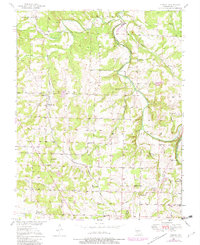
1950 Map of Cliquot
USGS Topo · Published 1975About this map
The St Louis San Francisco railroad cuts a diagonal path through this corner of Polk County, serving the small community of Cliquot. This mid-century landscape is defined by the winding Pomme de Terre River and its numerous tributaries, including Ashlock Creek and Flint Creek. The map documents a dense network of rural infrastructure, particularly the many country schools that once anchored local life, such as Heydon Sch, Moore Sch, and Cooper Sch.
Find a feature on this map
35 named features on this map. Tap any name to fly to it.
Don’t see what you’re looking for? This feature index may not catch every label — zoom into the map to look around manually.
Map Details
Editions of this 1950 Cliquot Map
2 editions found
Other maps of this area

1884 · Bolivar
USGS Topo · 1:125,000

1886 · Stockton
USGS Topo · 1:125,000

1892 · Bolivar
USGS Topo · 1:125,000

1942 · Elkton
USGS Topo · 1:24,000

1944 · Humansville
USGS Topo · 1:24,000

1949 · Elkton
USGS Topo · 1:24,000

1949 · Sentinel
USGS Topo · 1:24,000

1950 · Elkton
USGS Topo · 1:24,000

1950 · Sentinel
USGS Topo · 1:24,000

1950 · Polk
USGS Topo · 1:24,000