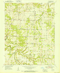
1951 Map of Polk
USGS Topo · Published 1951About this map
The Pomme De Terre River and Hominy Creek define the southern landscape of this 1950s Polk County survey, where small rural communities are connected by a network of one-room schools and country churches. The map documents a classic Ozark settlement pattern with hamlets like Huron, Polk, and Goodson serving as local hubs for the surrounding townships of McKinley and Marion.
Find a feature on this map
30 named features on this map. Tap any name to fly to it.
Don’t see what you’re looking for? This feature index may not catch every label — zoom into the map to look around manually.
Map Details
Editions of this 1951 Polk Map
2 editions found

Other maps of this area

1884 · Bolivar
USGS Topo · 1:125,000

1892 · Bolivar
USGS Topo · 1:125,000

1942 · Elkton
USGS Topo · 1:24,000

1949 · Elkton
USGS Topo · 1:24,000

1949 · Sentinel
USGS Topo · 1:24,000

1950 · Elkton
USGS Topo · 1:24,000

1950 · Sentinel
USGS Topo · 1:24,000

1950 · Buffalo NW
USGS Topo · 1:24,000

1950 · Polk
USGS Topo · 1:24,000

1950 · Urbana
USGS Topo · 1:24,000