
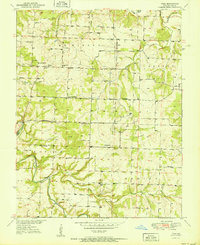
1951 Map of Polk
USGS Topo · Published 1951About this map
Pomme De Terre River winds through this central Missouri landscape, serving as a primary geographical anchor for several rural townships including McKinley, Greene, Marion, and Benton. The settlement pattern at mid-century is defined by small agricultural hubs like Polk and Huron, connected by a dense network of country schools and churches. Public life in the early 1950s centered on local institutions such as Green Leaf Sch, Union Sch, and Spring Valley Ch. Significant water features like Lindley Creek, Panther Creek, and Hominy Creek drain the area, while the Jefferson Bridge provides a critical crossing over the main river channel. For genealogists, the inclusion of several family-named burial sites, including Payne Cem and Goff Cem, provides specific points for tracing local family history.
Find a feature on this map
33 named features on this map. Tap any name to fly to it.
Don’t see what you’re looking for? This feature index may not catch every label — zoom into the map to look around manually.
Map Details
Editions of this 1951 Polk Map
2 editions found
Other maps of this area

1884 · Bolivar
USGS Topo · 1:125,000

1892 · Bolivar
USGS Topo · 1:125,000

1942 · Elkton
USGS Topo · 1:24,000

1949 · Elkton
USGS Topo · 1:24,000

1949 · Sentinel
USGS Topo · 1:24,000

1950 · Elkton
USGS Topo · 1:24,000

1950 · Sentinel
USGS Topo · 1:24,000

1950 · Buffalo NW
USGS Topo · 1:24,000

1950 · Polk
USGS Topo · 1:24,000

1950 · Urbana
USGS Topo · 1:24,000