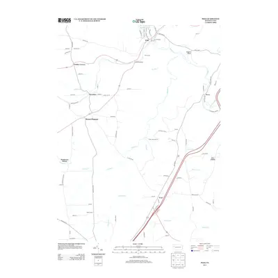
2013 Map of Polk
USGS Topo · Published 2013About this map
Polk Junction and the borough of Polk anchor this Venango County landscape, where the confluence of Sandy Cr and its various tributaries shaped the early development of the region. The map highlights a network of rural crossroads and small hamlets such as Raymilton, Henderson Station, and Pearl, which historically served as local hubs for farming and small-scale industry. The winding course of Little Sandy Cr flows past Polk Dam Lake, while numerous runs like Bear Run and Bullion Run carve through the terrain.
Find a feature on this map
85 named features on this map. Tap any name to fly to it.
Don’t see what you’re looking for? This feature index may not catch every label — zoom into the map to look around manually.
Map Details
Editions of this 2013 Polk Map
This is the sole edition of this map. No revisions or reprints were ever made.
Other maps of this area

1909 · Franklin
USGS Topo · 1:62,500

1910 · Hilliards
USGS Topo · 1:62,500

1911 · Franklin
USGS Topo · 1:62,500

1911 · Stoneboro
USGS Topo · 1:62,500

1912 · Hilliards
USGS Topo · 1:62,500

1913 · Stoneboro
USGS Topo · 1:62,500

1913 · Mercer
USGS Topo · 1:62,500

1939 · Mercer
USGS Topo · 1:62,500

1943 · Mercer
USGS Topo · 1:62,500

1943 · Stoneboro
USGS Topo · 1:62,500