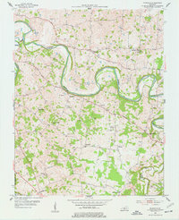
1954 Map of Polkville
USGS Topo · Published 1977About this map
The winding loops of the Barren River dominate this mid-century landscape in Warren and Allen counties, where rural life revolved around scattered crossroads and small-scale resource extraction. By the mid-1950s, numerous Oil Wells and at least one Gas Well were established across the countryside, particularly near Hardcastle and Greenhill. The map preserves the locations of vital community anchors like Berea Ch, Bethany Ch, and the Alvaton Sch, alongside family-named landmarks such as the Kimbrough Cem and Petty Cem. Evidence of aviation and infrastructure is seen in the Bowling Green Radio Range Station and the Iron Bridge crossing. The boundary line between Allen Co and Warren Co cuts through the southeastern corner, while primary thoroughfares like Porter Road and Cemetery Road connect the agricultural interior to larger regional hubs.
Find a feature on this map
31 named features on this map. Tap any name to fly to it.
Don’t see what you’re looking for? This feature index may not catch every label — zoom into the map to look around manually.
Map Details
Editions of this 1954 Polkville Map
2 editions found
Other maps of this area

1921 · Bowling Green
USGS Topo · 1:62,500

1922 · Brownsville
USGS Topo · 1:62,500

1922 · Mammoth Cave
USGS Topo · 1:62,500

1923 · Bowling Green
USGS Topo · 1:62,500

1923 · Mammoth Cave
USGS Topo · 1:62,500

1923 · Brownsville
USGS Topo · 1:62,500

1926 · Scottsville
USGS Topo · 1:62,500

1954 · Evansville
USGS Topo · 1:250,000

1954 · Bowling Green North
USGS Topo · 1:24,000

1954 · Drake
USGS Topo · 1:24,000