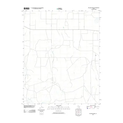
2010 Map of Pollard Creek
USGS Topo · Published 2010About this map
Pollard Creek and its neighboring drainages define this portion of Moore County, where the High Plains transition into a network of seasonal watercourses. The landscape is largely structured by the energy industry and rural access, as evidenced by the presence of Natural Gas Rd and the lone settlement marker at Sneed Camp in the eastern reaches. The grid of country roads, including Skelly School Rd and Keith Rd, connects a series of intermittent creeks like Sand Creek and Turkey Creek that carve through the Texas panhandle terrain. This 2010 survey illustrates a quiet corner of the state where the primary human footprint is found in the intersection of petroleum infrastructure and traditional ranching access, with several named waterways like Big Blue Creek and Grapevine Creek converging in the southern section.
Find a feature on this map
17 named features on this map. Tap any name to fly to it.
Don’t see what you’re looking for? This feature index may not catch every label — zoom into the map to look around manually.
Map Details
Editions of this 2010 Pollard Creek Map
This is the sole edition of this map. No revisions or reprints were ever made.
Other maps of this area

1936 · Fourways
USGS Topo · 1:62,500

1939 · Sanford
USGS Topo · 1:62,500

1953 · Sanford
USGS Topo · 1:24,000

1953 · Evans Canyon
USGS Topo · 1:24,000

1953 · Spencer Draw
USGS Topo · 1:24,000

1954 · Amarillo
USGS Topo · 1:250,000

1958 · Amarillo
USGS Topo · 1:250,000
1970 · Sanford
USGS Topo · 1:24,000
1972 · Little Blue Creek
USGS Topo · 1:24,000

1972 · Dumas NE
USGS Topo · 1:24,000