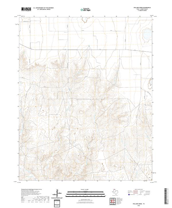
2022 Map of Pollard Creek
USGS Topo · Published 2022About this map
Moore County's high plains landscape is defined by the intricate dendritic drainage patterns carved into the Texas Panhandle. Pollard Cr and Turkey Cr dominate the central topography, creating a series of breaks and draws that contrast with the dead-flat agricultural tablelands above. The presence of Natural Gas Rd points to the region's long-standing reliance on energy extraction from the Hugoton-Panhandle Gas Field. Local transport follows a rigid section-line grid, exemplified by Keith Rd and Hooks Rd, which abruptly shifts as the terrain drops toward the Big Blue Cr and Grapevine Cr watersheds. This survey provides a modern snapshot of a rural landscape where industrial utility and natural erosion meet, revealing the subtle ways that water and energy infrastructure organize the modern High Plains.
Find a feature on this map
19 named features on this map. Tap any name to fly to it.
Don’t see what you’re looking for? This feature index may not catch every label — zoom into the map to look around manually.
Map Details
Editions of this 2022 Pollard Creek Map
This is the sole edition of this map. No revisions or reprints were ever made.
Other maps of this area

1936 · Fourways
USGS Topo · 1:62,500

1939 · Sanford
USGS Topo · 1:62,500

1953 · Sanford
USGS Topo · 1:24,000

1953 · Evans Canyon
USGS Topo · 1:24,000

1953 · Spencer Draw
USGS Topo · 1:24,000

1954 · Amarillo
USGS Topo · 1:250,000

1958 · Amarillo
USGS Topo · 1:250,000
1970 · Sanford
USGS Topo · 1:24,000
1972 · Little Blue Creek
USGS Topo · 1:24,000

1972 · Dumas NE
USGS Topo · 1:24,000