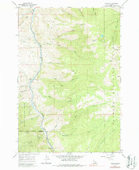
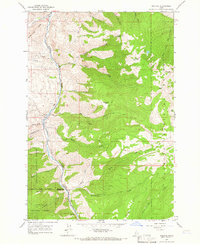
1964 Map of Pollock
USGS Topo · Published 1987About this map
The Little Salmon River carves a deep path through the canyonlands of western Idaho, serving as a vital corridor between the Nez Perce National Forest and the Payette National Forest. This mid-century landscape is defined by its dramatic elevation changes, with White Bird Ridge and Sheep Mountain towering over the narrow river valley where the small settlements of Pollock and Pinehurst are situated. The map illustrates a transitional zone where the forest boundaries meet the Idaho County and Adams County line. While the higher elevations like Dempsey Flat and Devils Ladder are reached only by primitive tracks, the river bottom shows signs of activity including a Gravel Pit and a Prospect site, reflecting the region's reliance on the land's raw resources.
Find a feature on this map
38 named features on this map. Tap any name to fly to it.
Don’t see what you’re looking for? This feature index may not catch every label — zoom into the map to look around manually.
Map Details
Editions of this 1964 Pollock Map
2 editions found
Other maps of this area

1938 · Riggins
USGS Topo · 1:96,000

1945 · Riggins
USGS Topo · 1:125,000

1955 · Grangeville
USGS Topo · 1:250,000

1959 · Grangeville
USGS Topo · 1:250,000

1963 · Indian Mountain
USGS Topo · 1:24,000
1963 · Hazard Lake
USGS Topo · 1:24,000
1963 · Pollock Mountain
USGS Topo · 1:24,000
1964 · Patrick Butte
USGS Topo · 1:24,000

1964 · Riggins
USGS Topo · 1:24,000
1964 · Pollock
USGS Topo · 1:24,000