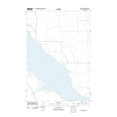
2011 Map of Pollock NW
USGS Topo · Published 2011About this map
The Missouri River dominates this section of the border between South Dakota and North Dakota, where the wide river channel is flanked by the low-lying terrain of Kenel Flats. This area in the Kenel District reflects a landscape primarily defined by water and sparse rural infrastructure. Near the northern edge of the map, the South Branch Cattail Creek flows through the prairie, while Hunkpapa Creek enters the Missouri further south. For those researching local history, the Dale Cemetery sits near the intersection of several township roads in the northeast, providing a clear genealogical anchor for the surrounding rural community. The road network is strictly rectangular, including 99th St SW and Main Ave, marking the systematic division of land in this river-border region.
Find a feature on this map
14 named features on this map. Tap any name to fly to it.
Don’t see what you’re looking for? This feature index may not catch every label — zoom into the map to look around manually.
Map Details
Editions of this 2011 Pollock NW Map
This is the sole edition of this map. No revisions or reprints were ever made.
Other maps of this area

1953 · McIntosh
USGS Topo · 1:250,000

1954 · Bismarck
USGS Topo · 1:250,000

1958 · Bismarck
USGS Topo · 1:250,000

1958 · McIntosh
USGS Topo · 1:250,000

1965 · Pollock SE
USGS Topo · 1:24,000

1965 · Pollock
USGS Topo · 1:24,000

1966 · Mahto NE
USGS Topo · 1:24,000

1966 · Kenel
USGS Topo · 1:24,000

1966 · Kline Buttes
USGS Topo · 1:24,000

1966 · Pollock NW
USGS Topo · 1:24,000