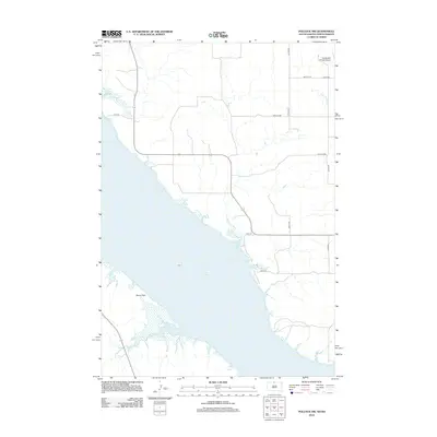
2012 Map of Pollock NW
USGS Topo · Published 2012About this map
Lake Oahe dominates the western portion of this landscape, its expansive shoreline shaping the geography of the Kenel Flats region. This 2012 survey illustrates the rugged interface between the Missouri River reservoir and the surrounding prairie of the Kenel District. The area maintains a rural character defined by a sparse network of county roads like 100th St SW and Main Ave. Local history and family ties are anchored by small-scale landmarks such as the Dale Cem and the Vander Wal Private Airport in the northeast corner. Drainage patterns are clearly marked by the S Br Cattail Cr, which meanders through the upper elevations, providing a detailed view of the watershed and the specific landforms created by the high-water line of the lake.
Find a feature on this map
15 named features on this map. Tap any name to fly to it.
Don’t see what you’re looking for? This feature index may not catch every label — zoom into the map to look around manually.
Map Details
Editions of this 2012 Pollock NW Map
This is the sole edition of this map. No revisions or reprints were ever made.
Other maps of this area

1953 · McIntosh
USGS Topo · 1:250,000

1954 · Bismarck
USGS Topo · 1:250,000

1958 · Bismarck
USGS Topo · 1:250,000

1958 · McIntosh
USGS Topo · 1:250,000

1965 · Pollock SE
USGS Topo · 1:24,000

1965 · Pollock
USGS Topo · 1:24,000

1966 · Mahto NE
USGS Topo · 1:24,000

1966 · Kenel
USGS Topo · 1:24,000

1966 · Kline Buttes
USGS Topo · 1:24,000

1966 · Pollock NW
USGS Topo · 1:24,000