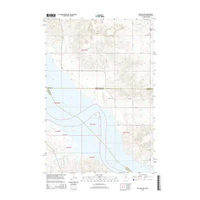
2015 Map of Pollock NW
USGS Topo · Published 2015About this map
Lake Oahe dominates this landscape along the border of North Dakota and South Dakota, where the Missouri River channel meets the expansive Kenel Flats. This 2015 survey illustrates a rural crossroads of aviation and local heritage, featuring the Vander Wal Private Airport and Dale Cem situated near the North Dakota state line. The topography is defined by the drainage systems of Hunkpapa Cr and S Br Cattail Cr, which carve through the high ground above the river valley. Transportation in this region relies on a network of Bureau of Indian Affairs and local routes, including Bia Rd 3 and Myers Bay RD, connecting dispersed ranchlands and river access points. The map provides a precise look at the jurisdictional boundaries where Emmons, Campbell, and Corson counties converge at the state divide.
Find a feature on this map
22 named features on this map. Tap any name to fly to it.
Don’t see what you’re looking for? This feature index may not catch every label — zoom into the map to look around manually.
Map Details
Editions of this 2015 Pollock NW Map
This is the sole edition of this map. No revisions or reprints were ever made.
Other maps of this area

1953 · McIntosh
USGS Topo · 1:250,000

1954 · Bismarck
USGS Topo · 1:250,000

1958 · Bismarck
USGS Topo · 1:250,000

1958 · McIntosh
USGS Topo · 1:250,000

1965 · Pollock SE
USGS Topo · 1:24,000

1965 · Pollock
USGS Topo · 1:24,000

1966 · Mahto NE
USGS Topo · 1:24,000

1966 · Kenel
USGS Topo · 1:24,000

1966 · Kline Buttes
USGS Topo · 1:24,000

1966 · Pollock NW
USGS Topo · 1:24,000