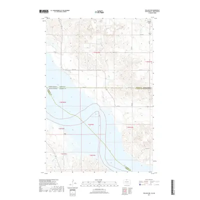
2017 Map of Pollock NW
USGS Topo · Published 2017About this map
Lake Oahe dominates this 2017 landscape where the borders of North Dakota and South Dakota converge with those of Emmons, Campbell, and Corson Counties. The map illustrates a high-plains geography defined by the Missouri River reservoir, which separates the rolling uplands from the Kenel Flats on the western shore. The area's agricultural and rural character is evidenced by the systematic grid of section lines and the persistence of local landmarks like the Dale Cem near the northern boundary. Inland from the water, drainage patterns such as Hunkpapa Cr and S Br Cattail Cr carve into the terrain. For those researching local history or aviation, the Vander Wal Private Airport and the descriptively named Stone Idol Pl provide specific points of reference within this sparsely settled borderland region.
Find a feature on this map
27 named features on this map. Tap any name to fly to it.
Don’t see what you’re looking for? This feature index may not catch every label — zoom into the map to look around manually.
Map Details
Editions of this 2017 Pollock NW Map
This is the sole edition of this map. No revisions or reprints were ever made.
Other maps of this area

1953 · McIntosh
USGS Topo · 1:250,000

1954 · Bismarck
USGS Topo · 1:250,000

1958 · Bismarck
USGS Topo · 1:250,000

1958 · McIntosh
USGS Topo · 1:250,000

1965 · Pollock SE
USGS Topo · 1:24,000

1965 · Pollock
USGS Topo · 1:24,000

1966 · Mahto NE
USGS Topo · 1:24,000

1966 · Kenel
USGS Topo · 1:24,000

1966 · Kline Buttes
USGS Topo · 1:24,000

1966 · Pollock NW
USGS Topo · 1:24,000