
1964 Map of Pollock NW
USGS Topo · Published 1965About this map
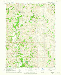
West Locust Creek and its many tributaries, including Hackett Creek and Badger Branch, define the rural landscape along the border of Putnam and Sullivan Counties. In the mid-1960s, this region remained dominated by small rural settlements and religious centers such as West Liberty Ch, Union Grove Ch, and Plainview Ch. The topography shows a highly dissected plateau where ridge-top roads connect isolated communities like Midway and Terre Haute. Local genealogy is well-represented through family-named landmarks and resting places, such as Parsons Cem and Spring Cem, located near the winding course of Locust Creek. The drainage patterns of Little Medicine Creek in the southwest corner illustrate the natural erosion of the Northern Plains terrain, while the sparse development underscores the agricultural character of these Missouri townships.
Find a feature on this map
23 named features on this map. Tap any name to fly to it.
Don’t see what you’re looking for? This feature index may not catch every label — zoom into the map to look around manually.
Map Details
Editions of this 1964 Pollock NW Map
This is the sole edition of this map. No revisions or reprints were ever made.
Other maps of this area

1942 · Seymour
USGS Topo · 1:62,500

1944 · Seymour
USGS Topo · 1:62,500

1954 · Centerville
USGS Topo · 1:250,000

1957 · Centerville
USGS Topo · 1:250,000

1958 · Centerville
USGS Topo · 1:250,000

1964 · Harris
USGS Topo · 1:24,000

1964 · Unionville West
USGS Topo · 1:24,000
1964 · Pollock
USGS Topo · 1:24,000
1964 · Pollock SW
USGS Topo · 1:24,000

1964 · Lucerne
USGS Topo · 1:24,000