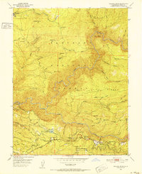
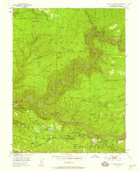
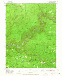
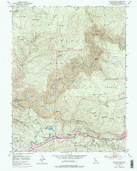
1950 Map of Pollock Pines
USGS Topo · Published 1952About this map
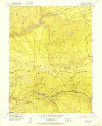
Pollock Pines and the surrounding timberlands of the Eldorado Nat Forest are documented here just as the post-war era transformed the Sierra Nevada foothills. The landscape is defined by the deep incision of the South Fork of the American River and its complex drainage system, including Silver Creek and Soldier Creek. This survey records the industrial infrastructure of the time, from the El Dorado Power House and its associated Pipe Line to the Dismantled Logging RR near Pino Grande, signaling a shift in how the forest was managed and harvested.
Find a feature on this map
59 named features on this map. Tap any name to fly to it.
Don’t see what you’re looking for? This feature index may not catch every label — zoom into the map to look around manually.
Map Details
Editions of this 1950 Pollock Pines Map
4 editions found
Other maps of this area

1889 · Pyramid Peak
USGS Topo · 1:125,000

1891 · Placerville
USGS Topo · 1:125,000

1891 · Pyramid Peak
USGS Topo · 1:125,000

1892 · Placerville
USGS Topo · 1:125,000

1893 · Placerville
USGS Topo · 1:125,000

1895 · Pyramid Peak
USGS Topo · 1:125,000

1896 · Pyramid Peak
USGS Topo · 1:125,000

1947 · Sacramento
USGS Topo · 1:250,000

1948 · Sacramento
USGS Topo · 1:250,000
1950 · Riverton
USGS Topo · 1:24,000