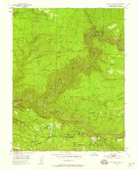
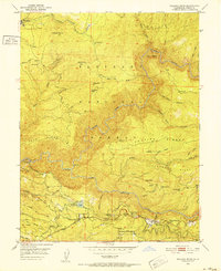
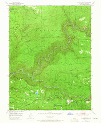
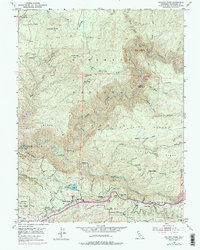
1950 Map of Pollock Pines
USGS Topo · Published 1958About this map
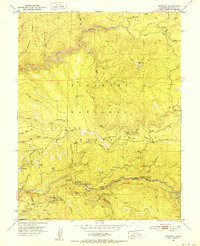
The South Fork American River carves a deep path through this mid-century survey of the western Sierra Nevada slopes. The map documents the region's industrial transitions, most notably the path of a Dismantled Logging Railroad near Pino Grande and the complex water infrastructure supporting the El Dorado Power House, including the Forebay and various irrigation canals.
Find a feature on this map
42 named features on this map. Tap any name to fly to it.
Don’t see what you’re looking for? This feature index may not catch every label — zoom into the map to look around manually.
Map Details
Editions of this 1950 Pollock Pines Map
4 editions found
Other maps of this area

1889 · Pyramid Peak
USGS Topo · 1:125,000

1891 · Placerville
USGS Topo · 1:125,000

1891 · Pyramid Peak
USGS Topo · 1:125,000

1892 · Placerville
USGS Topo · 1:125,000

1893 · Placerville
USGS Topo · 1:125,000

1895 · Pyramid Peak
USGS Topo · 1:125,000

1896 · Pyramid Peak
USGS Topo · 1:125,000

1947 · Sacramento
USGS Topo · 1:250,000

1948 · Sacramento
USGS Topo · 1:250,000
1950 · Riverton
USGS Topo · 1:24,000