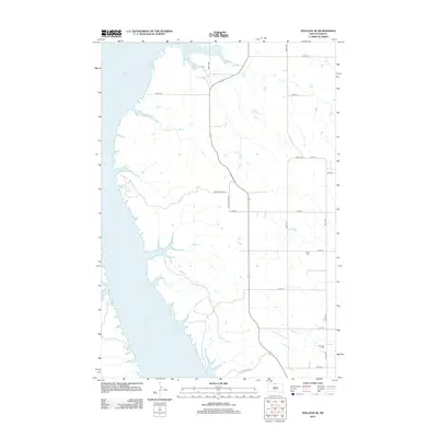
2012 Map of Pollock SE
USGS Topo · Published 2012About this map
Lake Oahe dominates the western edge of this prairie landscape, where the Missouri River's waters meet the rugged eastern plains of South Dakota. The topography is defined by the drainage of No Sweat Cr and Shaw Cr, which carve through the high ground towards the reservoir. Settlement patterns are sparse, organized around a rigid grid of rural roads such as 105th St and 296th Ave. For those researching local heritage, the map identifies small, isolated burial grounds including Gale Cem and Kvarness Cem, which serve as quiet landmarks for the families who farmed this region. The layout of modern routes like Point of View Rd and Leola River Pl indicates contemporary residential development or access points along the undulating shoreline of the lake.
Find a feature on this map
19 named features on this map. Tap any name to fly to it.
Don’t see what you’re looking for? This feature index may not catch every label — zoom into the map to look around manually.
Map Details
Editions of this 2012 Pollock SE Map
This is the sole edition of this map. No revisions or reprints were ever made.
Other maps of this area

1953 · McIntosh
USGS Topo · 1:250,000

1958 · McIntosh
USGS Topo · 1:250,000

1965 · Herreid NW
USGS Topo · 1:24,000

1965 · Herreid SW
USGS Topo · 1:24,000

1965 · Pollock SE
USGS Topo · 1:24,000

1965 · Pollock
USGS Topo · 1:24,000

1966 · Kenel
USGS Topo · 1:24,000

1966 · Pollock NW
USGS Topo · 1:24,000

1967 · Mobridge NE
USGS Topo · 1:24,000

1967 · Mobridge NW
USGS Topo · 1:24,000