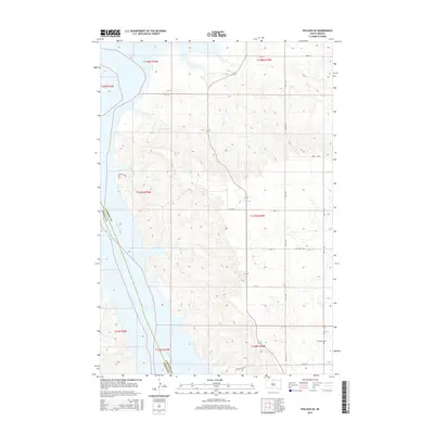
2015 Map of Pollock SE
USGS Topo · Published 2015About this map
The Missouri River and the expansive waters of Lake Oahe dominate the western landscape of this region along the border of Campbell and Corson Counties. This survey illustrates the modern topography of the Missouri basin following the mid-century inundation that created the reservoir. Away from the water, the terrain transitions into the upland drainages of No Sweat Creek and Shaw Creek, where the land is carved by the Prairie Hills. The eastern plateau is marked by a grid of rural routes like 295th Ave and 110th St, which provide access to localized historical markers including Gale Cemetery and Kvarness Cemetery. These small burial grounds remain as physical links to the early homesteading families who settled the plains before the river's transformation.
Find a feature on this map
26 named features on this map. Tap any name to fly to it.
Don’t see what you’re looking for? This feature index may not catch every label — zoom into the map to look around manually.
Map Details
Editions of this 2015 Pollock SE Map
This is the sole edition of this map. No revisions or reprints were ever made.
Other maps of this area

1953 · McIntosh
USGS Topo · 1:250,000

1958 · McIntosh
USGS Topo · 1:250,000

1965 · Herreid NW
USGS Topo · 1:24,000

1965 · Herreid SW
USGS Topo · 1:24,000

1965 · Pollock SE
USGS Topo · 1:24,000

1965 · Pollock
USGS Topo · 1:24,000

1966 · Kenel
USGS Topo · 1:24,000

1966 · Pollock NW
USGS Topo · 1:24,000

1967 · Mobridge NE
USGS Topo · 1:24,000

1967 · Mobridge NW
USGS Topo · 1:24,000