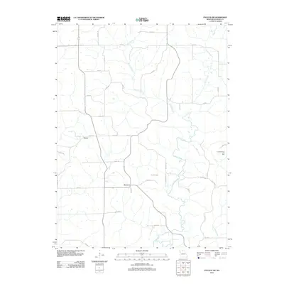
2012 Map of Pollock SW
USGS Topo · Published 2012About this map
Bairdston and Judson sit within a landscape of winding watercourses and rural corridors in this 2012 study of Sullivan County. The area is defined by the drainage of Locust Creek, which snakes south through the center of the map, joined by tributaries such as Rooks Branch and Elmwood Branch. The terrain is navigated by a network of local roads including Highway ZZ and Maple Rd, reflecting a traditional Midwestern settlement pattern where small community hubs are linked by long-established section-line routes.
Find a feature on this map
40 named features on this map. Tap any name to fly to it.
Don’t see what you’re looking for? This feature index may not catch every label — zoom into the map to look around manually.
Map Details
Editions of this 2012 Pollock SW Map
This is the sole edition of this map. No revisions or reprints were ever made.
Other maps of this area

1946 · Galt
USGS Topo · 1:62,500

1949 · Galt
USGS Topo · 1:62,500

1954 · Centerville
USGS Topo · 1:250,000

1957 · Centerville
USGS Topo · 1:250,000

1958 · Centerville
USGS Topo · 1:250,000

1964 · Pollock NW
USGS Topo · 1:24,000

1964 · Harris
USGS Topo · 1:24,000

1964 · Milan West
USGS Topo · 1:24,000
1964 · Milan East
USGS Topo · 1:24,000

1964 · Unionville West
USGS Topo · 1:24,000