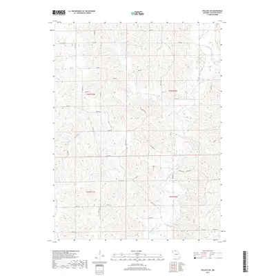
2017 Map of Pollock SW
USGS Topo · Published 2017About this map
Locust Creek and its many tributaries, including W Locust Cr and Rooks Br, dictate the topography of this Sullivan County landscape. The area is defined by a dense network of secondary roads and state highways, such as State Hwy EE and State Hwy K, which follow the winding ridgelines between drainage basins. Settlement patterns are dispersed, with numerous family-named roads like Jolly Rd, Joiner Rd, and Kay Rd providing access to rural homesteads. A central point of historical interest is the Hurst Cem, situated near the junction of Mesa Dr and Doral Dr. This modern survey reflects the enduring rural character of the region, where land divisions and transport routes remain closely tied to the natural flow of the local creek systems.
Find a feature on this map
43 named features on this map. Tap any name to fly to it.
Don’t see what you’re looking for? This feature index may not catch every label — zoom into the map to look around manually.
Map Details
Editions of this 2017 Pollock SW Map
This is the sole edition of this map. No revisions or reprints were ever made.
Other maps of this area

1946 · Galt
USGS Topo · 1:62,500

1949 · Galt
USGS Topo · 1:62,500

1954 · Centerville
USGS Topo · 1:250,000

1957 · Centerville
USGS Topo · 1:250,000

1958 · Centerville
USGS Topo · 1:250,000

1964 · Pollock NW
USGS Topo · 1:24,000

1964 · Harris
USGS Topo · 1:24,000

1964 · Milan West
USGS Topo · 1:24,000
1964 · Milan East
USGS Topo · 1:24,000

1964 · Unionville West
USGS Topo · 1:24,000