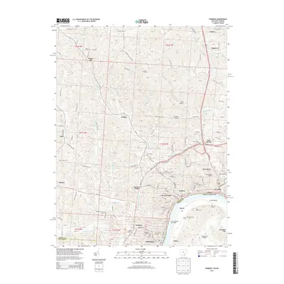
2013 Map of Pomeroy
USGS Topo · Published 2013About this map
The Ohio River carves a dramatic bend through this riverfront landscape, anchoring a dense network of nineteenth-century industrial and residential settlements across the Ohio and West Virginia border. This 2013 survey shows the tight clustering of communities like Pomeroy, Middleport, and Mason, where the steep topography of the Allegheny Plateau forces development into the narrow floodplains and hollows. The prevalence of family and community burial grounds, including Beech Grove Cem, Hiland Cem, and Adamsville Cem, provides significant genealogical touchpoints for researchers tracing the early families of Meigs County.
Find a feature on this map
107 named features on this map. Tap any name to fly to it.
Don’t see what you’re looking for? This feature index may not catch every label — zoom into the map to look around manually.
Map Details
Editions of this 2013 Pomeroy Map
This is the sole edition of this map. No revisions or reprints were ever made.
Other maps of this area

1907 · Pomeroy
USGS Topo · 1:62,500

1907 · Keno
USGS Topo · 1:62,500

1908 · Ravenswood
USGS Topo · 1:62,500

1908 · Point Pleasant
USGS Topo · 1:62,500

1926 · Ravenswood
USGS Topo · 1:62,500

1926 · Point Pleasant
USGS Topo · 1:62,500

1928 · Ravenswood
USGS Topo · 1:62,500

1929 · Point Pleasant
USGS Topo · 1:62,500

1947 · Columbus
USGS Topo · 1:250,000

1949 · Clarksburg
USGS Topo · 1:250,000