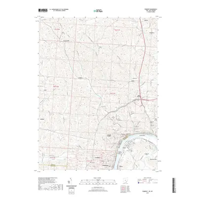
2019 Map of Pomeroy
USGS Topo · Published 2019About this map
The Ohio River carves a sharp turn at Pomeroy Bend, defining the industrial and civic heart of Meigs County. Along this riverfront, the settlements of Pomeroy, Middleport, and Mason form a dense corridor of commerce and government, anchored by the Meigs County Courthouse. The steep riverbanks lead inland to a landscape dissected by deep ravines like Long Hollow and Dark Hollow, where smaller communities such as Bradbury and Rock Springs occupy the narrow valleys and ridges.
Find a feature on this map
131 named features on this map. Tap any name to fly to it.
Don’t see what you’re looking for? This feature index may not catch every label — zoom into the map to look around manually.
Map Details
Editions of this 2019 Pomeroy Map
This is the sole edition of this map. No revisions or reprints were ever made.
Other maps of this area

1907 · Pomeroy
USGS Topo · 1:62,500

1907 · Keno
USGS Topo · 1:62,500

1908 · Ravenswood
USGS Topo · 1:62,500

1908 · Point Pleasant
USGS Topo · 1:62,500

1926 · Ravenswood
USGS Topo · 1:62,500

1926 · Point Pleasant
USGS Topo · 1:62,500

1928 · Ravenswood
USGS Topo · 1:62,500

1929 · Point Pleasant
USGS Topo · 1:62,500

1947 · Columbus
USGS Topo · 1:250,000

1949 · Clarksburg
USGS Topo · 1:250,000