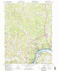
1992 Map of Pomeroy
USGS Topo · Published 1995About this map
The Ohio River flows past a dense industrial and residential corridor where the river bend creates a unique cross-state urban cluster. Pomeroy and Middleport anchor the Ohio bank, while Mason, Hartford, and Clifton line the West Virginia side. This landscape is heavily defined by the extraction economy, with extensive Strip Mines and numerous gas wells pockmarking the hills of Salisbury and Rutland. Local infrastructure reflects mid-century community life, including the Drive-in Theater and the Radio Tower (WMRN) perched above Bradbury. The hilly terrain is a network of cemeteries and family-named landmarks such as Horner Hill Cem and Leifheit Cem, illustrating the deep-rooted genealogy of Meigs County. Transport routes like Peach Fork Road and the Telephone Line follow the winding hollows of Sugar Run and Thomas Fork, connecting isolated settlements like Lima and Midway to the riverfront hubs.
Find a feature on this map
70 named features on this map. Tap any name to fly to it.
Don’t see what you’re looking for? This feature index may not catch every label — zoom into the map to look around manually.
Map Details
Editions of this 1992 Pomeroy Map
This is the sole edition of this map. No revisions or reprints were ever made.
Other maps of this area

1907 · Pomeroy
USGS Topo · 1:62,500

1907 · Keno
USGS Topo · 1:62,500

1908 · Ravenswood
USGS Topo · 1:62,500

1908 · Point Pleasant
USGS Topo · 1:62,500

1926 · Ravenswood
USGS Topo · 1:62,500

1926 · Point Pleasant
USGS Topo · 1:62,500

1928 · Ravenswood
USGS Topo · 1:62,500

1929 · Point Pleasant
USGS Topo · 1:62,500

1947 · Columbus
USGS Topo · 1:250,000

1949 · Clarksburg
USGS Topo · 1:250,000