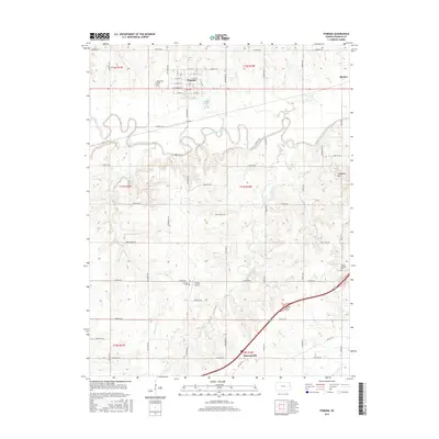
2015 Map of Pomona
USGS Topo · Published 2015About this map
The Marais des Cygnes River meanders across the central landscape of Franklin County, defining the drainage patterns for numerous tributaries like Lost Cr and Kelsey Cr. This 2015 U.S. Geological Survey representation of the area surrounding Pomona highlights a rural infrastructure built upon a grid of regionally named roads such as Arkansas Rd and Idaho Rd. The settlement of Pomona sits in the northern portion of the quadrangle, characterized by a traditional street plan including W Franklin St and several numbered avenues near Woodlawn Cem.
Find a feature on this map
56 named features on this map. Tap any name to fly to it.
Don’t see what you’re looking for? This feature index may not catch every label — zoom into the map to look around manually.
Map Details
Editions of this 2015 Pomona Map
This is the sole edition of this map. No revisions or reprints were ever made.
Other maps of this area

1885 · Burlington
USGS Topo · 1:125,000

1885 · Garnett
USGS Topo · 1:125,000

1885 · Lawrence
USGS Topo · 1:125,000

1889 · Burlingame
USGS Topo · 1:125,000

1889 · Lawrence
USGS Topo · 1:125,000

1894 · Garnett
USGS Topo · 1:125,000

1894 · Burlingame
USGS Topo · 1:125,000

1894 · Burlington
USGS Topo · 1:125,000

1947 · Lawrence
USGS Topo · 1:250,000

1950 · Lawrence
USGS Topo · 1:250,000