2024 Map of Pompeys Pillar
USGS Topo · Published 2024About this map
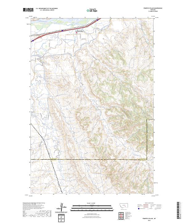
Pompeys Pillar National Monument overlooks the south bank of the Yellowstone River, marking a storied point of navigation and history in eastern Yellowstone County. The settlement of Pompeys Pillar is positioned along the northern transport corridor where Interstate 94 and Old Hwy 312 parallel the river's course. This area is defined by a sophisticated early 20th-century irrigation network, featuring the Huntley Main Canal and the Reservoir Line Canal, which divert water to support the valley's agricultural economy. Further south, the landscape shifts from the river valley into the broken terrain of the high plains, dissected by seasonal drainages like Fly Creek, Lost Boy Creek, and Smith Coulee. Local roads such as Sherrod Ln and Colton Rd provide access to the farms and ranches that span the county line into Big Horn County.
Find a feature on this map
33 named features on this map. Tap any name to fly to it.
Don’t see what you’re looking for? This feature index may not catch every label — zoom into the map to look around manually.
Map Details
Editions of this 2024 Pompeys Pillar Map
This is the sole edition of this map. No revisions or reprints were ever made.
Other maps of this area

1893 · Huntley
USGS Topo · 1:125,000

1894 · Fort Custer
USGS Topo · 1:125,000

1954 · Billings
USGS Topo · 1:250,000

1954 · Hardin
USGS Topo · 1:250,000

1954 · Forsyth
USGS Topo · 1:250,000

1954 · Roundup
USGS Topo · 1:250,000

1957 · Hardin
USGS Topo · 1:250,000

1957 · Forsyth
USGS Topo · 1:250,000

1957 · Billings
USGS Topo · 1:250,000

1958 · Billings
USGS Topo · 1:250,000