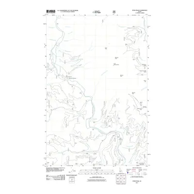
2011 Map of Pond Peak
USGS Topo · Published 2011About this map
The North Fork Coeur d'Alene River winds through the heart of this landscape in the Coeur d'Alene Mountains, anchoring a network of remote drainages and high ridges. High-elevation vantage points like Pond Peak and Little Guard Peak define the horizon, with the Little Guard Peak Lookout serving as a primary point of observation for the surrounding forest. The map reveals a land utilized for seasonal recreation and timber management, evidenced by the presence of Big Hank Campground and Devils Elbow Campground along the river's edge. Access to the high country is maintained via specialized routes such as the Little Guard Peak Rd and the Nat Forest Develop Road 1515 Trl. Water features are abundant, from the Yellow Dog Creek in the south to the headwaters of Sentinel Creek and Lion Creek further north.
Find a feature on this map
55 named features on this map. Tap any name to fly to it.
Don’t see what you’re looking for? This feature index may not catch every label — zoom into the map to look around manually.
Map Details
Editions of this 2011 Pond Peak Map
This is the sole edition of this map. No revisions or reprints were ever made.
Other maps of this area

1909 · Cataldo
USGS Topo · 1:125,000

1911 · Cataldo
USGS Topo · 1:125,000

1932 · Trout Creek
USGS Topo · 1:125,000

1935 · Trout Creek
USGS Topo · 1:125,000

1936 · Trout Creek
USGS Topo · 1:125,000

1955 · Spokane
USGS Topo · 1:250,000

1956 · Wallace
USGS Topo · 1:250,000

1957 · Burke
USGS Topo · 1:62,500

1957 · Kellogg
USGS Topo · 1:62,500

1958 · Spokane
USGS Topo · 1:250,000