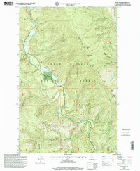
1996 Map of Pond Peak
USGS Topo · Published 1999About this map
Coeur D'Alene National Forest dominates this mountain landscape, which was updated by the Forest Service in the mid-1990s using topography originally compiled in 1965. The North Fork Coeur D'Alene River winds through the center of the sheet, carving a deep valley through the Shoshone Range. This waterway provides critical orientation for the area, featuring named points like Long Pool and the sharp bend at Devils Elbow. The map reflects a landscape managed for both timber and recreation, with a network of forest roads and trails reaching high summits such as Pond Peak and Sentinel Peak. Local land use is evidenced by the Gravel Pit near the river and the open expanse of Big Hank Meadow, while numerous drainages like Yellow Dog Creek and Beetle Creek feed into the primary river system.
Find a feature on this map
36 named features on this map. Tap any name to fly to it.
Don’t see what you’re looking for? This feature index may not catch every label — zoom into the map to look around manually.
Map Details
Editions of this 1996 Pond Peak Map
This is the sole edition of this map. No revisions or reprints were ever made.
Other maps of this area

1909 · Cataldo
USGS Topo · 1:125,000

1911 · Cataldo
USGS Topo · 1:125,000

1932 · Trout Creek
USGS Topo · 1:125,000

1935 · Trout Creek
USGS Topo · 1:125,000

1936 · Trout Creek
USGS Topo · 1:125,000

1955 · Spokane
USGS Topo · 1:250,000

1956 · Wallace
USGS Topo · 1:250,000

1957 · Burke
USGS Topo · 1:62,500

1957 · Kellogg
USGS Topo · 1:62,500

1958 · Spokane
USGS Topo · 1:250,000