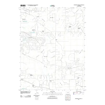
2010 Map of Ponderosa Park
USGS Topo · Published 2010About this map
The Pinery and Ponderosa Park anchor this landscape of residential developments and ranch lands south of Parker. The terrain is defined by a network of north-draining waterways, including Tallman Gulch, Cool Creek, and Bayou Gulch, which are punctuated by engineered water management features such as the Pinery Reservoir and Circle 2 Ranch Reservoir Number 1. These reservoirs and the Franktown Parker FPS-1 Dam indicate the suburban transformation of former agricultural land.
Find a feature on this map
93 named features on this map. Tap any name to fly to it.
Don’t see what you’re looking for? This feature index may not catch every label — zoom into the map to look around manually.
Map Details
Editions of this 2010 Ponderosa Park Map
This is the sole edition of this map. No revisions or reprints were ever made.
Other maps of this area

1890 · East Denver
USGS Topo · 1:125,000

1894 · Castle Rock
USGS Topo · 1:125,000

1913 · Castle Rock
USGS Topo · 1:125,000

1935 · East Denver Nos. 3 and 4
USGS Topo · 1:48,000

1939 · Elizabeth
USGS Topo · 1:62,500

1940 · Piney Creek
USGS Topo · 1:24,000

1940 · Castle Rock
USGS Topo · 1:62,500

1942 · Parker
USGS Topo · 1:31,680

1942 · Piney Creek
USGS Topo · 1:31,680

1945 · Castle Rock
USGS Topo · 1:62,500