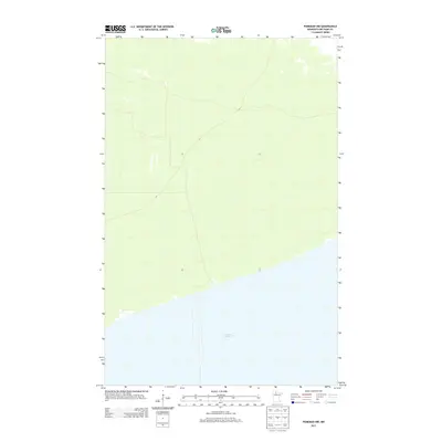
2013 Map of Ponemah NW
USGS Topo · Published 2013About this map
Upper Red Lake dominates the southern portion of this landscape, its expansive shoreline defining the geography of Beltrami County. This 2013 survey shows the north shore area before it reaches the deeper interior, illustrating the sparse network of roads and the subtle relief of the surrounding terrain. Produced by the U.S. Geological Survey using satellite imagery and elevation data, the map tracks the interface between the lake surface and the low-lying wetlands that characterize this part of northern Minnesota. This particular quadrangular view focuses on the unpopulated reaches northwest of Ponemah, where the water meets the shore in a relatively undisturbed state.
Find a feature on this map
1 named feature on this map. Tap any name to fly to it.
Don’t see what you’re looking for? This feature index may not catch every label — zoom into the map to look around manually.
Map Details
Editions of this 2013 Ponemah NW Map
This is the sole edition of this map. No revisions or reprints were ever made.
Other maps of this area

1918 · F
USGS Topo · 1:62,500

1919 · G
USGS Topo · 1:62,500

1919 · Ponemah
USGS Topo · 1:62,500

1943 · Ponemah
USGS Topo · 1:62,500

1954 · Roseau
USGS Topo · 1:250,000

1957 · Roseau
USGS Topo · 1:250,000

1958 · Roseau
USGS Topo · 1:250,000

1973 · Manomin Creek SE
USGS Topo · 1:24,000

1973 · Manomin Creek
USGS Topo · 1:24,000
1973 · Sucker Creek
USGS Topo · 1:24,000