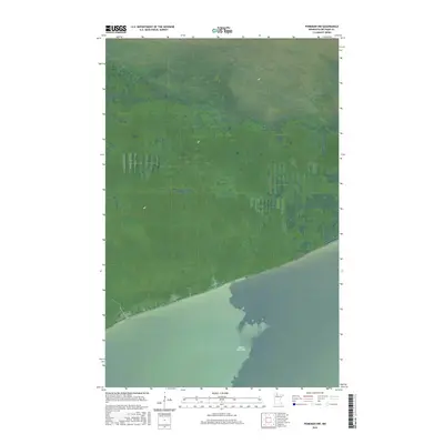
2016 Map of Ponemah NW
USGS Topo · Published 2016About this map
Upper Red Lake dominates the southern reaches of this landscape in Beltrami County, marking a stark transition between open water and the vast wetland complex to the north. This specific 2016 survey illustrates the precise shoreline within the Red Lake Indian Reservation, where the terrain is almost entirely defined by marsh and saturated lowlands. The grid of the Public Land Survey System, including t155n r34w and t155n r33w, overlays a territory remarkably devoid of modern development or road networks, reflecting the preserved and natural character of the northern Minnesota wilderness. This map is a critical reference for understanding the hydrological boundaries and section lines in an area where the environment dictates the patterns of human footprint and land management.
Find a feature on this map
5 named features on this map. Tap any name to fly to it.
Don’t see what you’re looking for? This feature index may not catch every label — zoom into the map to look around manually.
Map Details
Editions of this 2016 Ponemah NW Map
This is the sole edition of this map. No revisions or reprints were ever made.
Other maps of this area

1918 · F
USGS Topo · 1:62,500

1919 · G
USGS Topo · 1:62,500

1919 · Ponemah
USGS Topo · 1:62,500

1943 · Ponemah
USGS Topo · 1:62,500

1954 · Roseau
USGS Topo · 1:250,000

1957 · Roseau
USGS Topo · 1:250,000

1958 · Roseau
USGS Topo · 1:250,000

1973 · Manomin Creek SE
USGS Topo · 1:24,000

1973 · Manomin Creek
USGS Topo · 1:24,000
1973 · Sucker Creek
USGS Topo · 1:24,000