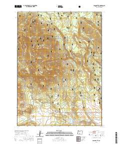
2020 Map of Ponina Butte
USGS Topo · Published 2020About this map
Ponina Butte and the Black Hills rise above a landscape defined by water sources and forest management within the Fremont National Forest. This 2020 topographic study of Klamath County documents a network of named springs and ponds, such as Pelland Spring and Lonesome Pond, which serve as vital landmarks in this high-country terrain. The transition from industrial forestry to recreational use is clearly marked by the Woods Line Rails-To-Trails in the southeastern corner, repurposing old timber corridors for modern passage.
Find a feature on this map
31 named features on this map. Tap any name to fly to it.
Don’t see what you’re looking for? This feature index may not catch every label — zoom into the map to look around manually.
Map Details
Editions of this 2020 Ponina Butte Map
This is the sole edition of this map. No revisions or reprints were ever made.
Other maps of this area

1889 · Klamath
USGS Topo · 1:250,000

1894 · Klamath
USGS Topo · 1:250,000

1955 · Klamath Falls
USGS Topo · 1:250,000

1958 · Klamath Falls
USGS Topo · 1:250,000

1960 · Riverbed Butte
USGS Topo · 1:62,500

1960 · Bly
USGS Topo · 1:62,500

1960 · Beatty
USGS Topo · 1:62,500

1960 · Fuego Mountain
USGS Topo · 1:62,500

1980 · Williamson River
USGS Topo · 1:100,000
1988 · Riverbed Butte Spring
USGS Topo · 1:24,000