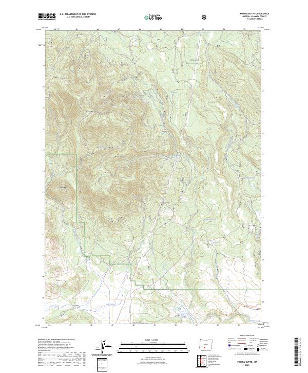
2023 Map of Ponina Butte
USGS Topo · Published 2023About this map
Ponina Butte rises above the high-elevation landscape of the Fremont National Forest in this contemporary record of Klamath County. The terrain is defined by the Black Hills and the prominent Huckleberry Draw, with drainage provided by watercourses like Ponina Creek and Mill Creek. A network of small, isolated water bodies such as Lonesome Pond, Wild Pond, and Ace Pond are scattered throughout the timberland. Of particular interest to historians and recreationists is the Woods Line Rails To Trails Trl in the southeast corner, which marks the former path of the region's logging rail infrastructure. Modern road access is detailed via Sycan Rd and Five Mile Creek Rd, while springs like Pelland Spr and Dice Spring hint at the hydrology that supported early ranching and forestry efforts.
Find a feature on this map
30 named features on this map. Tap any name to fly to it.
Don’t see what you’re looking for? This feature index may not catch every label — zoom into the map to look around manually.
Map Details
Editions of this 2023 Ponina Butte Map
This is the sole edition of this map. No revisions or reprints were ever made.
Other maps of this area

1889 · Klamath
USGS Topo · 1:250,000

1894 · Klamath
USGS Topo · 1:250,000

1955 · Klamath Falls
USGS Topo · 1:250,000

1958 · Klamath Falls
USGS Topo · 1:250,000

1960 · Riverbed Butte
USGS Topo · 1:62,500

1960 · Bly
USGS Topo · 1:62,500

1960 · Beatty
USGS Topo · 1:62,500

1960 · Fuego Mountain
USGS Topo · 1:62,500

1980 · Williamson River
USGS Topo · 1:100,000
1988 · Riverbed Butte Spring
USGS Topo · 1:24,000