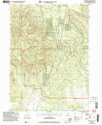
2004 Map of Ponina Butte
USGS Topo · Published 2007About this map
Fremont National Forest dominates this section of Klamath County, where high volcanic terrain meets a complex network of springs and drainage draws. The landscape is defined by Ponina Butte and the Black Hills, serving as a high-altitude watershed for numerous water sources including Petland Spring, Mill Creek Spring, and the headwaters of Swamp Creek. The presence of several Cinder Pit locations suggests the geological history of the area, while names like Huckleberry Draw reflect the local ecology. Human activity is marked by Forest Service infrastructure at Foster Field and a series of managed water bodies such as Powerline Pond and Electric Pond. The lower elevations in the south are crossed by Fivemile Creek and Snake Creek, illustrating the transition from timbered uplands to the watercourses that feed the Klamath Basin.
Find a feature on this map
26 named features on this map. Tap any name to fly to it.
Don’t see what you’re looking for? This feature index may not catch every label — zoom into the map to look around manually.
Map Details
Editions of this 2004 Ponina Butte Map
This is the sole edition of this map. No revisions or reprints were ever made.
Other maps of this area

1889 · Klamath
USGS Topo · 1:250,000

1894 · Klamath
USGS Topo · 1:250,000

1955 · Klamath Falls
USGS Topo · 1:250,000

1958 · Klamath Falls
USGS Topo · 1:250,000

1960 · Riverbed Butte
USGS Topo · 1:62,500

1960 · Bly
USGS Topo · 1:62,500

1960 · Beatty
USGS Topo · 1:62,500

1960 · Fuego Mountain
USGS Topo · 1:62,500

1980 · Williamson River
USGS Topo · 1:100,000
1988 · Riverbed Butte Spring
USGS Topo · 1:24,000