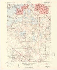
1952 Map of Pontiac South
USGS Topo · Published 1954About this map
Glacial lake clusters and suburban development define the landscape of south Oakland County in the early 1950s. The region is marked by an extensive network of recreational and institutional grounds, including the Oakland Hills Country Club and St Marys College on the shores of Pine Lake. Residential expansion is visible through numerous neighborhood schools like Bloomfield Village Sch and Walnut Lake Sch, while the Grand Trunk Western RR and the Northwestern Highway facilitate connections to the urban centers of Pontiac and Detroit. Traditional burial grounds such as Pine Lake Cem and Franklin Cem remain as markers of earlier settlement. Small aviation interests are represented by the Krist-Port Airport near the border of Farmington, showing the era's diversifying transportation infrastructure alongside established corridors like Telegraph Road.
Find a feature on this map
92 named features on this map. Tap any name to fly to it.
Don’t see what you’re looking for? This feature index may not catch every label — zoom into the map to look around manually.
Map Details
Editions of this 1952 Pontiac South Map
2 editions found
Other maps of this area

1905 · Wayne
USGS Topo · 1:62,500

1905 · Detroit
USGS Topo · 1:62,500

1907 · Pontiac
USGS Topo · 1:62,500

1908 · Rochester
USGS Topo · 1:62,500

1912 · Wayne
USGS Topo · 1:62,500

1918 · Detroit
USGS Topo · 1:62,500

1924 · Detroit
USGS Topo · 1:62,500

1934 · Detroit
USGS Topo · 1:62,500

1936 · Birmingham
USGS Topo · 1:31,680

1936 · Clarkston
USGS Topo · 1:31,680