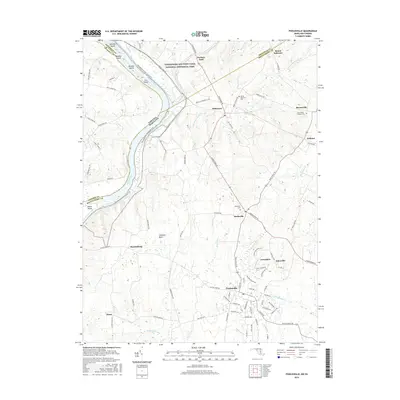
2016 Map of Poolesville
USGS Topo · Published 2016About this map
The Potomac River defines the western edge of this Montgomery County landscape, where the Chesapeake and Ohio Canal National Historical Park preserves a critical corridor of regional transportation history. This 2016 survey illustrates a cluster of well-established crossroads communities including Beallsville, Dickerson, and Barnesville, each connected by a network of historic thoroughfares like Dickerson Rd and Beallsville Rd. The town of Poolesville serves as a central hub, surrounded by smaller settlements such as Jerusalem and Jonesville.
Find a feature on this map
91 named features on this map. Tap any name to fly to it.
Don’t see what you’re looking for? This feature index may not catch every label — zoom into the map to look around manually.
Map Details
Editions of this 2016 Poolesville Map
This is the sole edition of this map. No revisions or reprints were ever made.
Other maps of this area

1884 · Harpers Ferry
USGS Topo · 1:125,000

1891 · Harpers Ferry
USGS Topo · 1:125,000

1893 · Frederick
USGS Topo · 1:125,000

1893 · Harpers Ferry
USGS Topo · 1:125,000

1894 · Frederick
USGS Topo · 1:125,000

1908 · Middletown
USGS Topo · 1:48,000

1908 · Seneca
USGS Topo · 1:62,500

1908 · Ijamsville
USGS Topo · 1:62,500

1909 · Ijamsville
USGS Topo · 1:62,500

1910 · Antietam
USGS Topo · 1:62,500