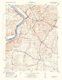
1944 Map of Poolesville
USGS Topo · Published 1944About this map
The Potomac River corridor serves as the primary axis for this wartime survey, showing the intricate relationship between water transport and early rail. The Chesapeake and Ohio Canal parallels the river, featuring the Monocacy Aqueduct at the confluence of the Monocacy River. This engineering landmark stands as a central point in a landscape defined by traditional ferry crossings and agricultural hamlets. Inland, the Baltimore and Ohio railroad cuts through the terrain, supporting settlements like Dickerson and Barnesville.
Find a feature on this map
35 named features on this map. Tap any name to fly to it.
Don’t see what you’re looking for? This feature index may not catch every label — zoom into the map to look around manually.
Map Details
Editions of this 1944 Poolesville Map
2 editions found
Other maps of this area

1884 · Harpers Ferry
USGS Topo · 1:125,000

1891 · Harpers Ferry
USGS Topo · 1:125,000

1893 · Frederick
USGS Topo · 1:125,000

1893 · Harpers Ferry
USGS Topo · 1:125,000

1894 · Frederick
USGS Topo · 1:125,000

1908 · Middletown
USGS Topo · 1:48,000

1908 · Seneca
USGS Topo · 1:62,500

1908 · Ijamsville
USGS Topo · 1:62,500

1909 · Ijamsville
USGS Topo · 1:62,500

1910 · Antietam
USGS Topo · 1:62,500