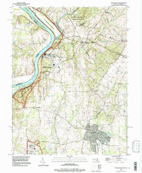
1995 Map of Poolesville
USGS Topo · Published 1997About this map
The Potomac River corridor and its historic island chain, including Nolands Island and Mason Island, dominate the western edge of this Montgomery County landscape. In the mid-1990s, the rural character of the region is preserved through significant parklands such as the C & O Canal National Historic Park, where the historic Towpath traces the riverbank. The map reveals a cluster of agricultural and residential hubs, from the larger town of Poolesville to smaller crossroad settlements like Beallsville and Dickerson.
Find a feature on this map
58 named features on this map. Tap any name to fly to it.
Don’t see what you’re looking for? This feature index may not catch every label — zoom into the map to look around manually.
Map Details
Editions of this 1995 Poolesville Map
This is the sole edition of this map. No revisions or reprints were ever made.
Other maps of this area

1884 · Harpers Ferry
USGS Topo · 1:125,000

1891 · Harpers Ferry
USGS Topo · 1:125,000

1893 · Frederick
USGS Topo · 1:125,000

1893 · Harpers Ferry
USGS Topo · 1:125,000

1894 · Frederick
USGS Topo · 1:125,000

1908 · Middletown
USGS Topo · 1:48,000

1908 · Seneca
USGS Topo · 1:62,500

1908 · Ijamsville
USGS Topo · 1:62,500

1909 · Ijamsville
USGS Topo · 1:62,500

1910 · Antietam
USGS Topo · 1:62,500