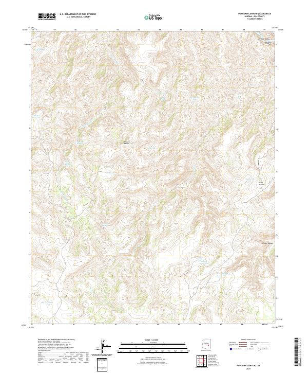
2021 Map of Popcorn Canyon
USGS Topo · Published 2021About this map
Salt River Canyon dominates the northeastern corner of this Gila County terrain, where the Salt River carves through the Salt River Valley. The landscape is defined by an intricate network of drainage systems, including Popcorn Canyon, Bronco Canyon, and the winding course of Cave Cr. Human presence is marked primarily by ranching infrastructure, such as Victor Pasture and a series of named water catchments crucial for survival in the arid environment. These include Dry Lake Tank, Martin Luther Tank, and Fiftysix Tank. Reliable water sources are further identified at Popcorn Spring, Cave Creek Spring, and Little Trough Spring, providing a detailed record of the essential water points used throughout these canyons.
Find a feature on this map
29 named features on this map. Tap any name to fly to it.
Don’t see what you’re looking for? This feature index may not catch every label — zoom into the map to look around manually.
Map Details
Editions of this 2021 Popcorn Canyon Map
This is the sole edition of this map. No revisions or reprints were ever made.
Other maps of this area

1954 · Mesa
USGS Topo · 1:250,000

1957 · Mesa
USGS Topo · 1:250,000

1958 · Mesa
USGS Topo · 1:250,000

1960 · Mesa
USGS Topo · 1:250,000

1964 · Mesa
USGS Topo · 1:250,000

1966 · Brushy Canyon
USGS Topo · 1:24,000

1966 · Popcorn Canyon
USGS Topo · 1:24,000
1966 · Forks Butte
USGS Topo · 1:24,000

1966 · Cassadore Spring
USGS Topo · 1:24,000
1966 · Cone Butte
USGS Topo · 1:24,000