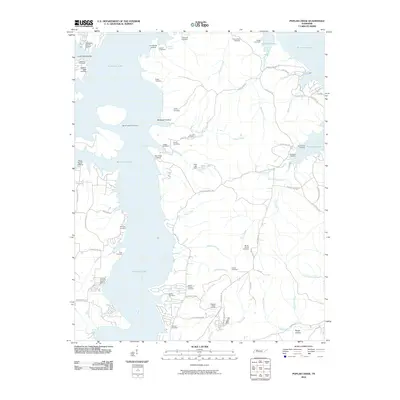
2010 Map of Poplar Creek
USGS Topo · Published 2010About this map
Kentucky Lake dominates the western shoreline of this Henry County landscape, where the irregular coast is defined by numerous inlets and landings. This 2010 survey illustrates a region shaped by its proximity to the water, featuring recreational sites like Mansard Island Resort and County Junction Resort alongside historic family and community landmarks. The interior is densely populated with small cemeteries, such as Bond-Limekiln Cemetery and Mount Zion Cemetery, which serve as vital markers for local genealogical research. Transportation patterns are dictated by the lake's reach, with roads like Winn Ferry Rd and Danville Rd connecting the upland ridges to the water's edge. Significant creek systems, including Poplar Creek and Lick Creek, flow through the terrain, with Dyer Lake Dam appearing as a notable point of water management in the central portion of the quadrangle.
Find a feature on this map
74 named features on this map. Tap any name to fly to it.
Don’t see what you’re looking for? This feature index may not catch every label — zoom into the map to look around manually.
Map Details
Editions of this 2010 Poplar Creek Map
This is the sole edition of this map. No revisions or reprints were ever made.
Other maps of this area

1936 · Poplar Creek
USGS Topo · 1:24,000

1936 · Buchanan
USGS Topo · 1:24,000

1936 · McKinnon
USGS Topo · 1:24,000

1936 · Big Sandy
USGS Topo · 1:24,000

1936 · Centerville Landing
USGS Topo · 1:24,000

1936 · Harmon Creek
USGS Topo · 1:24,000

1936 · Standing Rock
USGS Topo · 1:24,000

1936 · Manleyville
USGS Topo · 1:24,000

1936 · Springville
USGS Topo · 1:24,000

1938 · Springville
USGS Topo · 1:24,000