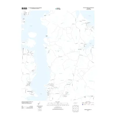
2013 Map of Poplar Creek
USGS Topo · Published 2013About this map
Kentucky Lake dominates this Western Tennessee landscape, where the inundated valleys of the Tennessee River system define the modern shoreline. The map documents a blend of mid-century recreation and older rural foundations, featuring established retreats like Mansard Island Resort and the County Junction Resort alongside traditional river access points such as Iron Bridge Landing and Lick Creek Landing. These landings, once critical for local transport and commerce, now serve as nodes for leisure and residential growth.
Find a feature on this map
115 named features on this map. Tap any name to fly to it.
Don’t see what you’re looking for? This feature index may not catch every label — zoom into the map to look around manually.
Map Details
Editions of this 2013 Poplar Creek Map
This is the sole edition of this map. No revisions or reprints were ever made.
Other maps of this area

1936 · Poplar Creek
USGS Topo · 1:24,000

1936 · Buchanan
USGS Topo · 1:24,000

1936 · McKinnon
USGS Topo · 1:24,000

1936 · Big Sandy
USGS Topo · 1:24,000

1936 · Centerville Landing
USGS Topo · 1:24,000

1936 · Harmon Creek
USGS Topo · 1:24,000

1936 · Standing Rock
USGS Topo · 1:24,000

1936 · Manleyville
USGS Topo · 1:24,000

1936 · Springville
USGS Topo · 1:24,000

1938 · Springville
USGS Topo · 1:24,000